About Changlang
Changlang is a district in Arunachal Pradesh. It is located in the eastern part of the state and shares its borders with Myanmar (Burma) in the southeast. The district is known for its scenic beauty, rich cultural heritage, and diverse ethnic groups.
Here are some key features and information about Changlang:
Geographical Location: Changlang is situated between the geographical coordinates of 26° 0′ 3″ North latitude and 95° 44′ 16″ East longitude. It covers an area of approximately 4,662 km. sq.
Population and Ethnicity: The district is home to various ethnic groups, including Tangsa, Tutsa, Nocte, Singpho, Lisu, and others. The population of Changlang district is predominantly tribal, and the people follow their indigenous customs, traditions, and languages.
Administration: Changlang serves as the headquarters of the Changlang district. It is further divided into four administrative circles: Changlang South, Changlang North, Khimiyong, and Miao. The district administration is responsible for the overall governance and development of the area.
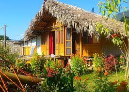
Natural Beauty: Changlang is blessed with picturesque landscapes, dense forests, rivers, and mountains. It offers breathtaking views and is a popular destination for nature enthusiasts and adventure seekers. Some notable tourist attractions in Changlang include Namdapha National Park, Miao Mini Zoo, and the scenic Noa-Dihing River.
Namdapha National Park: Located in Changlang district, Namdapha National Park is one of the largest protected areas in the Eastern Himalayan biodiversity hotspot. It is recognized as a Tiger Reserve and is known for its rich flora and fauna, including endangered species like the snow leopard, clouded leopard, and Hoolock gibbon.
Cultural Significance: The diverse ethnic groups of Changlang district have their unique cultural practices, festivals, and traditions. The locals engage in traditional dance forms, music, and handicrafts. The major festivals celebrated in the district include Pongtu, Sangken, and Rongali Bihu.
Economy: The economy of Changlang is primarily agrarian, with agriculture and horticulture being the main occupations of the local population. The district is known for producing crops like rice, millet, maize, and fruits such as oranges, apples, and pineapples. The presence of natural resources like timber and minerals also contributes to the economy.
Connectivity: Changlang is well-connected by road, and buses and taxis are the primary modes of transportation within the district. The nearest railway station is Tinsukia in Assam, which is approximately 120 kilometers away. The nearest airport is Dibrugarh Airport in Assam, which is about 150 kilometers from Changlang.
Changlang district offers a unique blend of natural beauty, cultural diversity, and traditional heritage, making it an intriguing destination for travelers exploring the northeastern region of India.
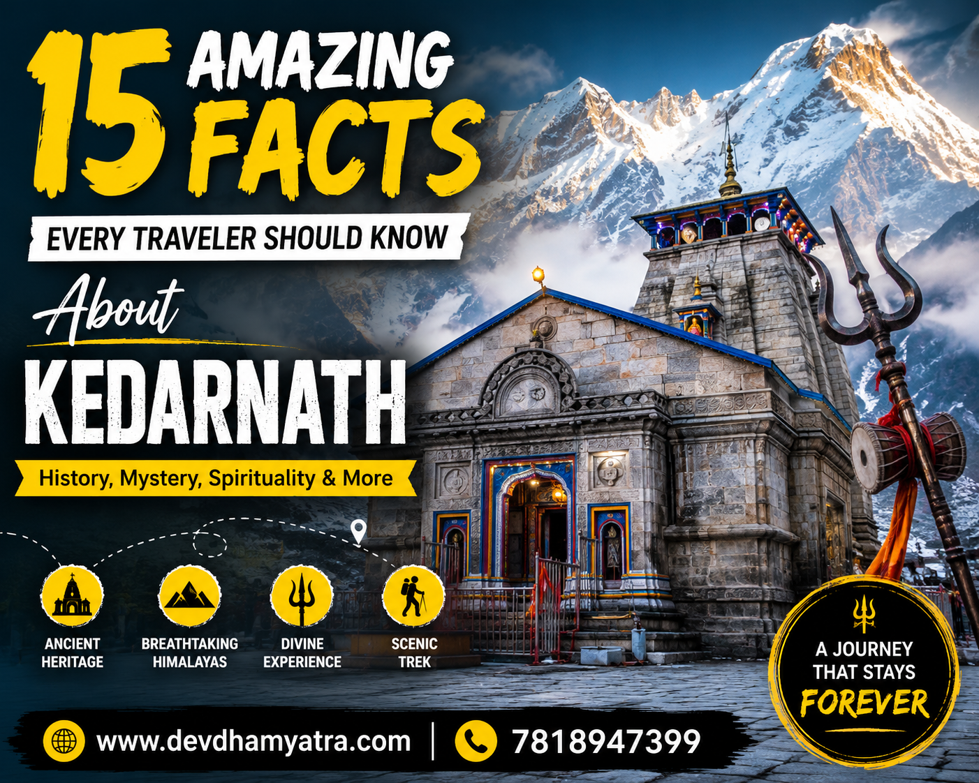
About Kedarnath
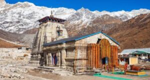
The town of Kedarnath is situated in the Rudraprayag district of Uttarakhand. It is located at a height of roughly 3,583 meters (11,755 feet) above sea level in the Garhwal Himalayas. One of the holiest Hindu pilgrimage sites dedicated to Lord Shiva, the Kedarnath Temple is one of Kedarnath’s most famous and historic landmarks.
Here are some key features and information about Kedarnath:
Kedarnath Temple: The Kedarnath Temple is the most significant attraction in the town. Adi Shankaracharya is thought to have constructed it in the eighth century. The temple is one of the twelve Jyotirlingas (divine representations of Lord Shiva) and is considered highly sacred by devotees of Lord Shiva. The temple’s architecture showcases intricate stone carvings and is surrounded by the majestic Kedarnath mountain range.
Pilgrimage Destination: Kedarnath is a major pilgrimage destination for devout Hindus. Every year, thousands of pilgrims undertake a challenging trek to reach the town, particularly during the pilgrimage season (usually from April to November). The trek to Kedarnath involves a steep ascent through scenic trails, passing through places like Gaurikund, Rambara, and Garud Chatti.
Char Dham Yatra: Kedarnath is one of the four sacred sites comprising the Char Dham Yatra, which includes Yamunotri, Gangotri, Kedarnath, and Badrinath. Pilgrims often undertake this holy journey to seek spiritual enlightenment and to pay homage to the deities associated with each destination.
Natural Beauty: Kedarnath is nestled amidst breathtaking natural surroundings. The town is located in the Mandakini River valley, surrounded by snow-capped peaks and scenic vistas. The area is known for its alpine meadows, glaciers, and pristine landscapes, offering a serene and picturesque ambiance.
Trekking and Adventure: Apart from its religious significance, Kedarnath is also a popular destination for trekking and adventure enthusiasts. The town serves as a base camp for treks to destinations like Vasuki Tal, Chorabari Tal (Gandhi Sarovar), and the trekking route to Badrinath via the Panpatia Col.
Extreme Weather Conditions: Due to its high altitude, Kedarnath experiences extreme weather conditions. The temperature can drop significantly, especially during the winter months when the region is covered in heavy snow. The pilgrimage season is generally limited to the summer and autumn months when the weather is relatively mild and the region is accessible.
Kedarnath holds immense religious and cultural significance and offers a unique blend of spirituality, natural beauty, and adventure. It continues to attract devotees and travelers alike who seek solace, tranquility, and a connection with the divine amidst the majestic Himalayan landscape.
Changlang to Kedarnath Distance
There are several ways to get from Changlang to Kedarnath. One has to travel around 2617 km from Changlang to reach Kedarnath. From Changlang to Kedarnath, the distance by air is around 1680 km.
Changlang to Kedarnath by Train
- One can take a bus from Changlang to reach Itanagar. Then, one can take a train from Itanagar to get to New Delhi. After that, take a bus or cab to Dehradun, and then another bus or cab to Kedarnath.
- Changlang- Itanagar (via bus)- New Delhi (via train)- Dehradun (via bus or cab)- Kedarnath (via cab or bus)
Changlang to Kedarnath Distance by Flight
Mohanbari Airport is the one that is most convenient to Changlang. Jolly Grant Airport in Dehradun is the closest airport to Kedarnath.
- To reach Itanagar from Changlang, travel via bus. Then, a flight can be taken from Itanagar to reach New Delhi. Take a bus or cab from New Delhi to reach Dehradun. From Dehradun, take a bus or cab to Gaurikund, Kedarnath.
- Changlang- Itanagar (via bus)- New Delhi (via flight)- Dehradun (via bus or cab)- Kedarnath (via bus or cab)
Travel Tips:
- Plan your visit: Examine the weather and make travel arrangements as necessary. Kedarnath is situated in the Garhwal Himalayas, and the weather can be unpredictable. The temple is usually open from April/May to October/November, but it’s always advisable to check the exact dates before you go.
- Acclimatize yourself: Kedarnath is located at an altitude of around 3,583 meters (11,755 feet). It’s essential to acclimatize yourself to the high altitude before you start the trek. Spend a day or two in a nearby place like Gaurikund or Sonprayag to allow your body to adjust to the altitude.
- Choose the right time to visit: The peak season for Kedarnath is during May and June, as well as September and October. These months offer better weather conditions and are less crowded compared to July and August, which is the monsoon season.
- Start early: Begin your trek to Kedarnath early in the morning to avoid the midday heat and crowds. It’s recommended to start your journey around 5-6 am. This will give you ample time to reach the temple and have a peaceful darshan (visit) without rushing.
- Be prepared for the trek: The trek to Kedarnath is approximately 16 kilometers (10 miles) long and involves a steep ascent. Wear comfortable trekking shoes and carry essentials like water, snacks, rain gear, a walking stick, and a small backpack. Dress in layers, as the temperature can vary during the journey.
- Stay hydrated: It’s crucial to stay hydrated during the trek, as the high altitude can cause dehydration. Carry an adequate amount of water and drink frequently to avoid any health issues. There are also several shops and tea stalls along the trekking route where you can buy water or other beverages.
- Pack essential medication: If you have any specific medical conditions, consult your doctor and carry the necessary medications with you. It’s also advisable to carry basic first aid supplies like band-aids, antiseptic cream, painkillers, etc.
- Accommodation options: There are various accommodation options available in Kedarnath, including guesthouses and dharamshalas (pilgrim rest houses). You can also find tents or camping facilities if you prefer to stay closer to nature. It’s advisable to book in advance during the peak season
- Be prepared for limited connectivity: Due to the remote location of Kedarnath, network connectivity can be limited. It’s better to inform your family and friends about the limited communication facilities, so they’re aware of any delays in contacting you.
FAQs:
Q: How much distance is between Changlang and Kedarnath?
A: The distance from Changlang to Kedarnath is approximately 2,617 kilometers by road and 1680 kilometers by air.
Q: How long does it take to travel from Changlang to Kedarnath?
A: The travel time from Changlang to Kedarnath can vary based on the mode of transportation and the route you choose. If you’re traveling by road, it can take around 2-3 days, depending on the stops and breaks. If you’re considering other modes of transport like trains or flights, you may need to plan additional time for transit and connections.
Q: Are there any direct flights or trains from Changlang to Kedarnath?
A: No, there are no direct flights or trains connecting Changlang to Kedarnath. You will need to take connecting flights or trains and then travel by road to reach Kedarnath.