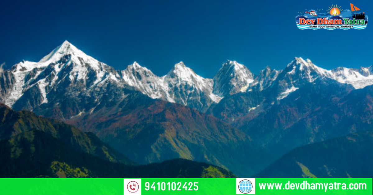
Panchachuli peaks are a group of five snow covered peaks in eastern kumaon of himalayan range, near Munsiyari in Pithoragarh District of Uttarakhand at the height of 4261m. The starting point of panchachuli base camp starts from Dar village, which is 42 kms ahead of Dharchula, which is the nearest town from panchachuli base camp. Taxi service is avilable from dharchula to Dar village. On the trail passing through dense forest magnificient view of green valley, wild flowers, and waterfalls can be seen.
Usually the trek takes 9 to 10 days. which makes it a perfect holiday for travel freaks.

Main highlights of Panchachuli
* State:- Uttarakhand
*District:- Pithoragarh
* Longitude and latitude:- 30.2142 degree N, 80.4275degree E
* Weather:- sunny, cloudy, snowy, rainy
* Sea level:- 4260
* Best time to visit:- summer (mid march to june)
Places to visit near Panchachuli Peaks Trek
- Khaliya Top
- Pindari Glacier Trek
- Maheshwari Kund
- Nanda Devi Temple
- Birthi Fall
Itinerary to Panchachuli Peaks Base Camp
Your starting point <–> Kathgodam <–> Almora <–> Dharchula <–> Tawaghat <–> Sobla <–> Dar <–> Urthing <-> Nagling <–> Son <–> Panchachuli Base Camp
How to reach
One can travel according to one’s available source (Taxi, bike,Bus,Train)
Nearest airport:- Pantnagar airport , 160kms from Panchachuli
Nearest railway station:- Kathgodam, 135kms from Panchachuli
By bus: one can travel by bus to Almora or kathgodam
Stay in Panchachuli Peaks Trek
- Panchachuli Homestay
- Milam Inn
- Hotel Pandy Lodge
- Vijay Mount view Resort
Things to do in Panchachuli peaks Trek
- Do photo shoot of mesmerizing view
- Trekking, hiking, and camping
- Sightseeing of Panchachuli Peaks
- Make new friends
Travel tips
- Do carry warm hiking clothes
- Do carry rain sheater
- To avoid dehydration carry enough water
- carry Hiking hat to avoid skin burn
- train yourself for trek before some days
- Check your high altitude medical conditions


 Shri Eklingji Temple in Udaipur, Rajasthan – A Sacred Marvel of Mewar


