Chopta is a small grassland and forest area. It is situated in Uttarakhand state, India. It is the initial place to start a trek to Tungnath (the third temple of Panch Kedar). The trek distance from Chopta to Tungnath is 3.5km.
Chopta is one of the best natural tourist places situated in Uttarakhand, India. Chopta is 2709 meters (8888ft) elevated above sea level. Chopta village is enclosed by pine, deodar, and rhododendron trees. Rare species of birds and musk deer are also seen there. Chopta is also known as ‘Mini Switzerland’ because it imposes a beautiful view of Trishul, Nanda Devi, and Chaukhamba.
It is recommended to visit Chopta from April to November. It is also famous during the months of winter because of the snowfall. Tungnath and Chandrashila also experience snowfall and are covered with snow from December to March. There are two ways to reach Chopta. That is from Rishikesh to Rudraprayag, kund, Ukhimath or from Rudraprayag, Karnprayag, Chamoli, Gopeshwar, Mandal.
One can simply reach Chopta because it lies on the road which connects Gopeshwar with Guptkashi. Chopta shows a remarkable morning view with a magnificent sunrise when sun rays caress the snow on the Himalayas.
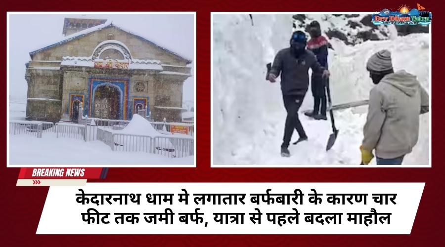
Chopta is a place which is not been fully discovered yet. It is a place that must be visited by a person who loves nature and trekking. The climate of Chopta is very cool and nice. From March to May temperature lies between 10-30 degrees celsius. Chopta experiences monsoon season from July to December. After that, the snowfall season starts from November to March, the temperature lies between -15 to 15 degrees celsius. Chopta experiences a large amount of snowfall around 4 to 7 feet. Due to heavy snowfall routes to Chopta got blocked. But there is another route to Chopta which is from Deoria Tal.
TUNGNATH:
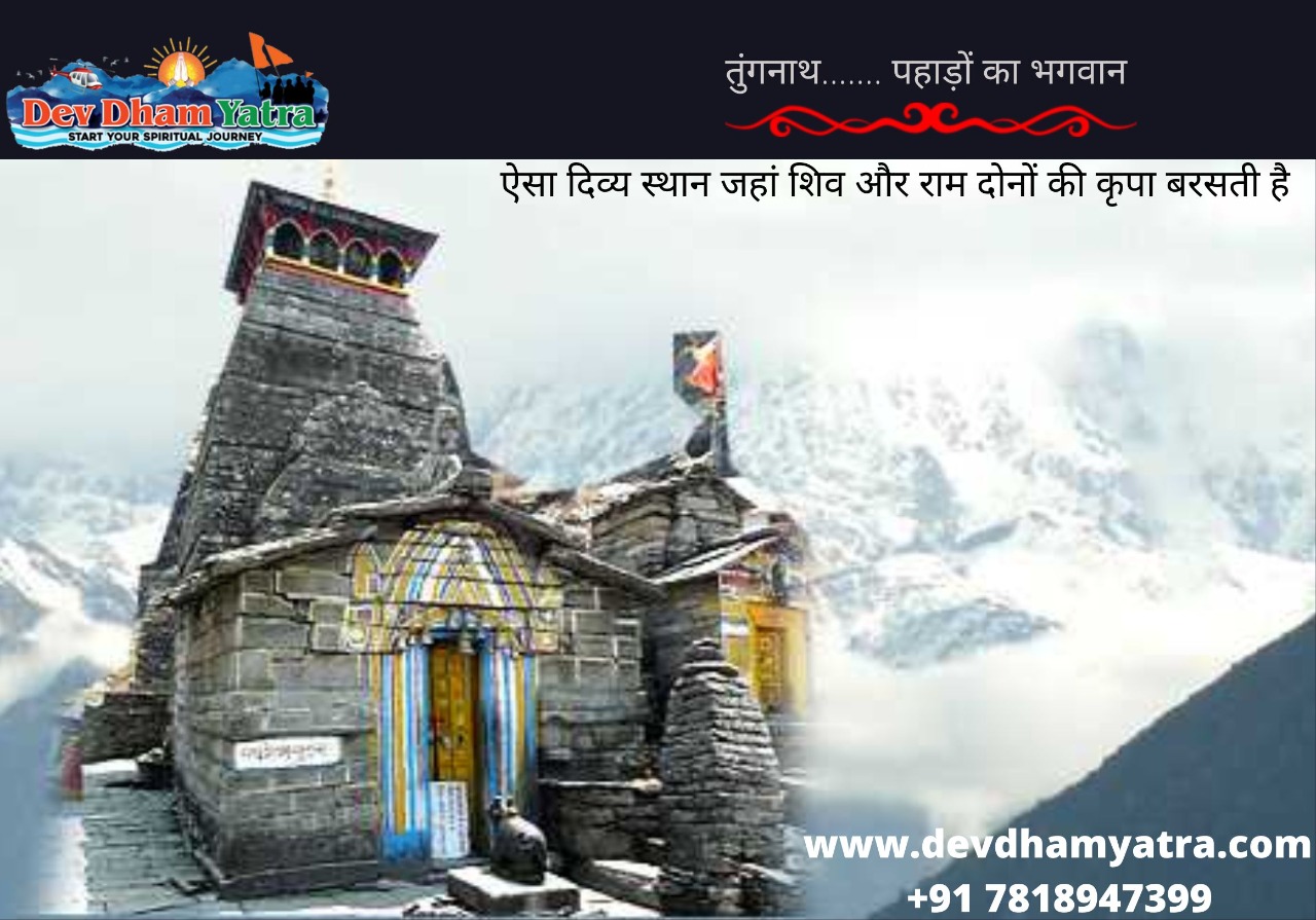
Tungnath Temple is the highest Shiva temple among the five Panch Kedar. It is situated in the Rudraprayag district of Uttarakhand state. The meaning of Tungnath is Lord of the Peaks. The river valleys Mandakini and Alaknanda were found by The Tungnath Mountains. Tungnath is 3470m (11,385 ft) above sea level and lies just below the peak of Chandrashila. Tungnath is related to the Pandavas and Mahabharata. The temperature in Tungnath mostly remains cool the whole year. Summers had a temperature of around 16 degrees Celsius. Winters in Tungnath are very cold and the temperature drops very often. One should visit Tungnath between April to September. Tungnath remains closed during winter because of the heavy snowfall. Tungnath has the shortest route as compared to other Panch Kedar trekking routes. Tungnath is only 5km (3.1mi) from Chopta. This distance can be managed in 4-5 hours.
The priest in this temple is a native Brahmin from Makku village, not like other Kedar temples that had priests from South India.
Call us for more details: 7818947399
Places to visit in Chopta Tungnath Uttarakhand:
There are many magnificent places near Chopta Tungnath Uttarakhand that should be visited by tourists.
Auli:
Auli is another popular hill station in Uttarakhand. It is a famous ski resort in India. It provides a wonderful view of the mountain peaks covered with snow.
Anusuya Devi Temple & Atri Muni Ashram:
Anusuya Devi Temple is located in Chamoli which is the temple committed to goddess Sati, the wife of Atri Muni. Atri Muni was one of the Sapta Rishis.
Makkumath:
Makkumath is a village located in Rudraprayag district and had an elevation of 2100mts. It is 20kms far from Chopta Tungnath Uttarakhand which can be reached in 34 minutes.
Sari Village:
Sari Village is located at a height of 2000mts, Sari Village is a spectacular small town that lies 20kms before Chopta Tungnath Uttarkhand. Sari Village is packed with oak and rhododendron trees.
Deoria Tal:
Deoria Tal is a lake situated at a height of 2438 mts above sea level. Deoria Tal is the best place for trek lovers.
Ukhimath:
Ukhimath is located at a height of 1317 mts above sea level in the Rudraprayag district. Ukhimath is also known as Okhimath. Lord Kedarnath and Madhyamaheshwar both reside at Ukhimath during winters.
Omkareshwar Temple:
Omkareshwar temple is a popular temple located at Ukhimath, in the Rudraprayag district of Uttarakhand. The temple is located at a height of 1300 mts. The distance from Omkareshwar temple to Chopta Tungnath Uttarakhand is approximately 31 kms.
Gopeshwar:
Gopeshwar is located at an elevation of 1300 meters above sea level. Gopeshwar is popular for its pleasant weather, natural beauty, and for the Gopinath temple. It is 37 kms away from Chopta Tungnath Uttarakhand.